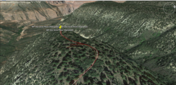
The azrun16.kmz file attached contains all the waypoints from the trail guide (Thanks again Jesse) and the track(s) my phone recorded.
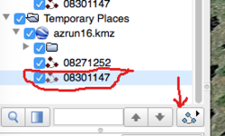
The GoogleEarthPlaces.png file shows what to clicky click once you open the file in Google Earth to FLY the run. There are two tracks. I circled the second one.
Once you get that to work - you can move your mouse toward the lower left of the picture to make a play button doodad like your music player has pop-up, that will let you drag the timer or click fast forward a couple times so you can move through the file without investing 7 days.
Move your mouse toward the mid-upper right on the picture to bring up the little street view guy with a height slider so you can zoom in or out to see more view.


